
The Geographic Information Systems Center (GIS) faculty and staff engage in research opportunities that help enrich the GIS curriculum and provides solutions to challenging spatial problems. GIS Center research also provides our students with life experiences only obtained by working on real-world problems first-hand.
PROJECTS
Below are examples of the collaborations for various land and shoreline surveys as well as custom mapping to provide real-time solutions using GIS mapping.
GIS RESEARCH ARCHIVES
Description
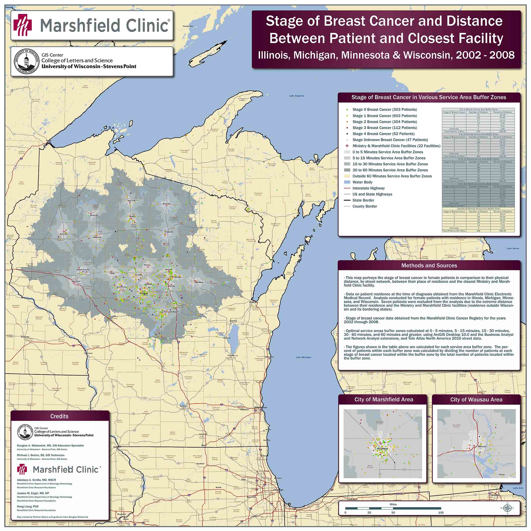
In cooperation with the Marshfield Clinic, the GIS Center researched the relationship between the stage of breast cancer at initial diagnosis and the distances patients travel to receive screening. The powerful analytical capabilities of GIS have long linked personal health location factors.
Investigators:
Dr. Adedayo Onitilo, MD, MSCR, Marshfield Clinic
Jessica Engel, MSN, RN, Marshfield Clinic
Douglas Miskowiak, UWSP GIS Center
Hong Liang, Ph.D. Marshfield Clinic
Rachel Stankowski, Ph,D. Marshfield Clinic
Michael Broton, UWSP GIS Center
Description
Grindstone Lake Association has an active history in learning more about lake and shore lake resources and in leading conservation efforts to improve the ecology and aesthetics of Grindstone Lake. The effort to compile data included in this plan extends the association’s efforts in conserving the area’s special resources. In this initiative, citizens from Grindstone Lake partnered with professionals from various organizations to inventory watershed and shoreline characteristics important for lake planning and conservation efforts. Throughout the process citizens have invested generously with their time and energy. With professionals training citizens inventoried emergent aquatic macrophytes, coarse woody habitat, aquatic invasive species, shoreline development, riparian trees, veteran trees, aesthetic characteristics, lake- bottom structure, and wildlife. Equipped with new skills, citizens inventoried over 12 miles of shoreline documenting ecological and aesthetic characteristics, features, and indicators.
Through past planning and management efforts are common on Grindstone Lake, This report is the first known systematic, spatial assessment of Grindstone Lakes’ characteristics. These spatial inventories provide an objective snapshot of the resources that exist along the Grindstone Lake shoreline, riparian area, and littoral zone during the summer of 2010. These data, preserved using Geographic Information Systems (GIS), not only serve the interests of this planning project, but will also serve to monitor changed on and around Grindstone Lake over time.
Investigators: Doug Miskowiak, UWSP GIS education specialist, and student investigators, Jon Galloy, Michael Broton and Corinna Neeb
Description
On May 5, 2005, a man clearing his land near the unincorporated community of Cottonville, Wisconsin in Adams County ignited what has come to be known as the Cottonville Fire. The fire burned 3,410 acres through the communities of Big Flats, Preston and Culburn and destroyed 30 homes and dozens of other structures. Ironically, the landowner used fire to clear his land to make it less susceptible to wildfire.
The Cottonville Fire is one of the most thoroughly documented major fires in Wisconsin history. Technology has afforded the means to quickly collect and present documentation of the fire with maps, photographs, damage assessments, after action reviews, and other records. Initial documentation was centralized by the Wisconsin Department of Natural Resources (WDNR) using Esri’s ArcView 3.X software – GIS software popular in the 1990’s and early 2000’s. Project files and data were shared with the UWSP GIS Center for publishing and serving data on the internet for public consumption and education. The resulting web-maps provide a geographically-enabled means to warehouse information, communicate a complex spatial narrative and promote better understanding about wildfire.
Investigators: John Hintz, WDNR forestry staff specialist and Doug Miskowiak, UWSP GIS education specialist
Description
This project analyzes the potential vulnerability of agricultural lands to soil erosion in the Upper Couderay River Watershed. Soil erosion from agricultural lands produces a source of phosphorous to Lake Lac Courte Oreilles (LCO). An Erosion Vulnerability Index is presented indicating agricultural parcels that are potentially vulnerable to soil erosion and would benefit from implementing agricultural best management practices. The 125 square mile watershed contributes 12 billion gallons of water annually to LCO (LimnoTech, 2014). Practically the entire watershed contributes water to LCO – from its own local basin and from three inlets fed from the basins of five other area lakes. This characteristic of LCO makes it particularly susceptible to various water pollutants, including excessive nutrients.
LCO harbors a unqiue and susceptible stratified two-story fishery. The upper epilimnion story accommodates a self-sustaining musky and walleye fishery. The lower thermocline story harbors cisco and whitefish, species that require cold, well-oxygenated water. Cisco and whitefish are prey for walleye and musky. The two-story fishery is at risk from excessive phosphorous and climate change that affect the temperature and availability of oxygen in the small thermocline story (Pratt, 2014).
Measuring Erosion Vulnerability
Erosion vulnerability in the watershed is evaluated using the Erosion Vulnerability Assessment for Agricultural Lands (EVAAL) toolkit developed by the Wisconsin Department of Natural Resources (WDNR). Erosion vulnerability is evaluated by analyzing factors of: 1) Elevation, 2) Precipitation, 3) Soil Erodibility (K-Factor), 4) Crop Management (C-Factor), and 5) Crop Rotations. These factors are used to calculate: 1) Internally Draining Areas, 2) Runoff Curve, 3) Soil Loss Potential from Sheet and Rill Erosion (Universal Soil Loss Equation), and 4) Stream Power Index (Gully Erosion). The Erosion Vulnerability Index is a combination of Soil Loss Potential and Stream Power Index. The Erosion Vulnerability Index is then aggregated to the parcel level indicating which agricultural parcels are potentially most vulnerable to erosion and would benefit from implementing agricultural best management practices.
Investigators:
Douglas Miskowiak, UWSP GIS Center
Kyle McNair, GIS technician
Description
The Moose Lake Legacy Initiative has forged an exceptional partnership between citizens and resource professionals to inventory and analyze landscapes within the West Fork of the Chippewa River watershed. Particular attention has focused on the islands and shorelines of Moose Lake, in Sawyer County, Wisconsin. Throughout this initiative, citizen volunteers have invested generously with their time and energy. With help from professionals, they learned how to inventory coarse woody structure, aquatic macrophytes, aquatic invasive species, shoreline development, natural scenic beauty, ecological reference areas, and wildlife. Equipped with new skills, they inventoried 50 miles of shoreline looking for these ecological and aesthetic characteristics, features, and indicators.
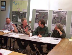
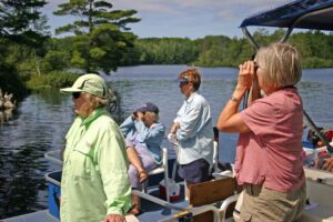
In many instances, the shoreline inventories have verified what residents and recreationalists already knew- Moose lake is a magnificent place, rich with Northwood’s beauty and teeming with wildlife. More importantly, the inventories provide an objective view of the existing resources and serve as a record-in-time that articulates Moose Lake’s bounty.
Investigator:
Douglas Miskowiak, UWSP GIS Center
Description
The Barn Project of Portage County is an initiative of the Portage County Historical Society and the University of Wisconsin-Stevens Point, GIS Center. Historical barns are disappearing across the Wisconsin landscape in large numbers. Structure loss from snow load, old age, and disinvestment due to the decline of the family farm are a few key reasons for loss. Barns share a slice of cultural history in Wisconsin that local people and tourists value. It is important to document this history, long after these structures disappear. The initiative has photo documented 1,516 barns from Portage County, Wisconsin. A group of 23 historical barn enthusiasts provided photo documentation. The GIS Center provided mapping tools to geo-locate each barn structure, and linked it to photographs provided by the historical society.
Description
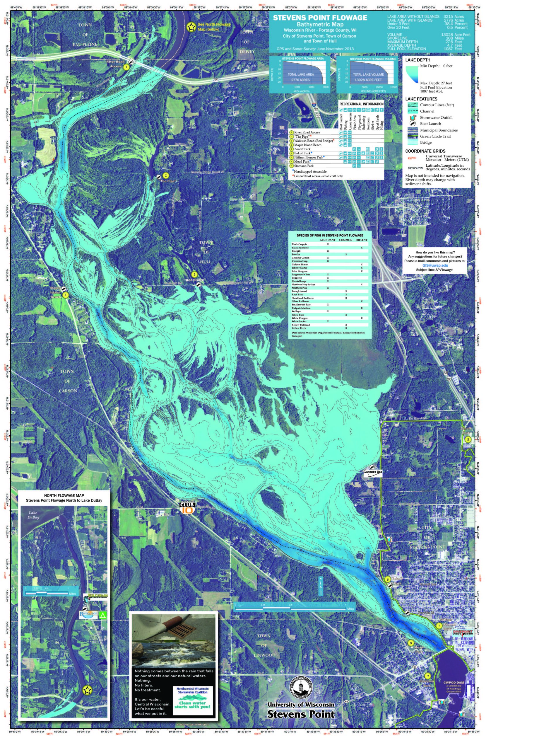
The Stevens Point Flowage Bathymetric Survey and Mapping Project was a cooperative partnership between the UWSP GIS Center and local non-profit organizations, local governments, businesses, and individuals. In 2013, GIS Center students and faculty completed a 2,800 acre bathymetric survey that documents flowage depths. Over 120,000 data points were collected over a period of 13-discontinuous days on the water. Students and faculty donated over 200 hours conducting the survey and crafting the map. Thank you to our community partners and friends for supporting the printing and distribution of over 5,000 flowage maps to the public. We hope you agree that this map is a functional resource for using and enjoying the Stevens Point Flowage of the Wisconsin River – the nation’s hardest working river.
Investigators:
Christine Koeller, project lead
Douglas Miskowiak, UWSP GIS Center
Keith Rice, GIS Center project advisor
CONTACT US
University of Wisconsin-Stevens Point
Department of Geography and Geology
D240 Science Building
2001 Fourth Avenue
Stevens Point, WI 54481-3897
Email: GIS@uwsp.edu
Phone: 715-346-2883