Facilities
GIS/Remote Sensing Laboratory and Classroom
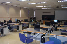 The GIS/Remote Sensing Laboratory and Classroom Complex are located in B-308 and B-312 and is used for GIS, cartographic, and remote sensing analysis. The B-308 and B-312 Labs have 27 workstation computers (HP xw4600), one large format plotter (HP DesignJet 800ps 42”), as well as a Calcomp large format scanner (Scan Plus 6 LF742). These devices are used for the production of large format maps, GIS displays, and orthophotography. There is also an Ashtech GPS base station with associated computer hardware used for differential positioning. Trimble Nomad GPS Receivers and TerraSync software are used to collect field data.
The Workstation quality PC’s have a wide variety of software available.
• ESRI ArcGIS Version 10
• Leica Erdas Desktop 2011
• Macromedia Freehand MXa and Adobe Director 11.5
• CorelDRAW x6
• SURFER 11
• MapViewer 7
• Adobe Master Collection 6
B-308 has 20 workstation quality computers that are used for classroom instruction and is available for student use when classes are not in session.
Spatial Information Analysis Laboratory (SIAL)
The Spatial Information Analysis Lab is a training lab dedicated to spatial data analysis, especially Geographic Information Systems (GIS). The lab is equipped with 21 student computers , an instructor station equipped with a SMART Podium 524, LCD TV with a SMART Board interactive display overlay and a1080p projection system. Computers are configured with several GIS software packages that include the ArcGIS (v 10) and ERDAS Desktop 2011. Students have the opportunity to use available on-line federal, state, and local digital databases in gaining GIS database construction experience.
Computer Geographics Laboratory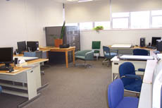
The Computer Geographics Laboratory provides access to specialized computer equipment for the facilitation of map production and geographic analyses. Contour maps, three-dimensional terrain surfaces, and socio-economic thematic maps are examples of products created by students and faculty in this lab.
The laboratory, which is located on the third floor of the Science Building (B346), has a wide range of computing equipment including:
• Five cartography/GIS pc workstations
• Hewlett Packard 5P black and white laser printer
• Hewlett Packard Color LaserJet 3800 printer
• A large 11” x 17” color flatbed scanner (Epson 10000XL)
Each computer hosts a variety of cartographic and GIS software such as:
• ESRI ArcGIS Version 10
• Leica Erdas Desktop 2011
• Macromedia Freehand MXa and Adobe Director 11.5
• CorelDRAW x6
• SURFER 11
• MapViewer 7
• Adobe Master Collection 6
Maurice E. Perret Map Center 
The Maurice E. Perret Map Center, located in Room B304 of the Science Building, is administrated by the Department of Geography/Geology and is open to use by the university community, as well as by the public. During the academic year, the Map Center is open on a regular basis (a schedule is posted near the Map Center entrance).
The Map Center is a depository for maps and charts of the U.S. Geological Survey and the National Geospatial Intelligence Agency (NGA). The collection includes:
• U.S. Geological Survey topographic maps of Wisconsin, and the other forty-nine states and territories, and some Canadian topographic maps
• Selected road maps of the United States and Canada
• Urban maps of selected Wisconsin cities
• U.S. Geological Survey maps of the geology of selected areas of the United States
• Aeronautical charts of the world
• Oceanographical and navigational maps
• The American Geographical Society map series on Latin America
• Miscellaneous maps of Wisconsin, the world, and of outer space made by various mapping agencies
• Selected aerial photographs and mosaics of central Wisconsin.
• Gazetteers and atlases
• CD/DVD-based digital map files (e.g., U.S. Census TIGER files 1992, 1997, 2000)
• DeLorme 3D-Topo Quads (all of U.S)
 Skip to main content
